Florida has declared a state of emergency across 25 counties as Tropical Storm Isaias strengthens in the Gulf of Mexico and moves toward the northern Gulf Coast.
The system was initially identified as Tropical Depression Nine after forming over the Gulf on October 6. It strengthened into Tropical Storm Isaias on October 7 and is forecast to intensify further. Weather officials are monitoring the system closely because it could become the first hurricane of the 2026 Atlantic hurricane season.
Florida Governor Ron DeSantis signed Executive Order 26 202 on October 6, declaring a state of emergency in 25 counties in preparation for the potential impacts of the storm. The order allows state emergency agencies to mobilise resources and prepare for possible flooding, strong winds and other weather related hazards.
Florida Declares State of Emergency
The state of emergency applies to 25 counties, mainly covering areas of the Florida Panhandle and northern parts of the state.
The counties included in the declaration are Baker, Bay, Calhoun, Columbia, Dixie, Escambia, Franklin, Gadsden, Gilchrist, Gulf, Hamilton, Holmes, Jackson, Jefferson, Lafayette, Leon, Liberty, Madison, Okaloosa, Santa Rosa, Suwannee, Taylor, Walton, Wakulla and Washington.
Governor DeSantis said the emergency declaration would allow Florida to stage critical preparedness resources before the storm potentially affects the state. He also urged residents to review their disaster plans and make sure hurricane supply kits are ready.
Emergency Resources Being Prepared
Florida's State Emergency Response Team has begun preparing resources in anticipation of possible storm impacts.
According to the governor's office, emergency supplies being staged include generators, fuel, flood barriers, drinking water, shelf stable meals, flood buckets, tarps, sandbags and other flood protection equipment.
The resources are being positioned in locations including Tallahassee and the Santa Rosa area so they can be deployed quickly if conditions deteriorate.
The early preparation is intended to reduce response times if the storm produces significant flooding, strong winds or other hazards.
Tropical Depression Nine Becomes Isaias
The weather system initially developed as Tropical Depression Nine over the Gulf of America on October 6.
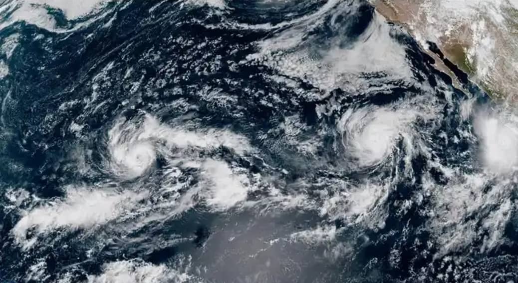
The National Hurricane Center reported that the depression was located southwest of the mouth of the Mississippi River and west of the Yucatan Peninsula when it formed. At the time, it had maximum sustained winds of 35 miles per hour and was moving eastward.
By October 7, the system strengthened into Tropical Storm Isaias. Current forecasts indicate that it could strengthen into a hurricane before reaching the northern Gulf Coast.
The National Hurricane Center has warned that the system is expected to strengthen quickly. The agency continues to issue regular advisories as forecasters assess its intensity and projected track.
Potential Hurricane Development
Forecasters expect Isaias to strengthen as it moves across the Gulf of Mexico.
Current projections indicate that the storm could reach hurricane strength before approaching the northern Gulf Coast later this week. Weather reports suggest that the system could become a Category 1 or stronger hurricane, although the exact intensity at landfall remains uncertain.
Warm Gulf waters can provide energy for tropical systems, allowing them to strengthen. At the same time, atmospheric conditions such as wind shear can limit development. As a result, the final strength of the storm could change as it approaches land.
The National Hurricane Center continues to monitor these factors and update its forecasts.
Possible Landfall Area
The precise landfall location remains uncertain.
Current forecast models suggest that the storm could approach the northern Gulf Coast between parts of Louisiana and the Florida Panhandle. The exact location could change considerably as the system develops and its steering currents become clearer.
Weather forecasts indicate that areas east of the storm's centre could experience significant rainfall and strong winds. The Florida Panhandle is among the regions being closely monitored because of the potential for coastal impacts.
Residents should therefore rely on official weather updates rather than earlier forecast tracks, which can change as a tropical system moves.
Heavy Rain and Flooding Threat
Heavy rainfall is one of the major concerns associated with Isaias.
North Florida has already experienced significant rainfall in recent weeks, which could increase the risk of flooding if additional heavy rain falls over saturated ground.
The Florida governor's office warned that heavy rainfall, strong winds, coastal flooding and isolated tornadoes could affect North Florida.
Flash flooding could become a concern in low lying areas and locations that receive repeated heavy rainfall. Drivers are also advised to exercise caution on roads if water begins accumulating.
Storm Surge and Coastal Risks
Coastal communities along the northern Gulf Coast could face additional hazards as the storm approaches.
Storm surge can push seawater inland and cause flooding along coastal areas. The severity of the surge depends on the storm's intensity, size, direction and angle of approach.
Strong winds can also produce dangerous waves and worsen coastal flooding.
Because the exact track remains uncertain, authorities are closely monitoring the storm before issuing more specific watches or warnings.
Residents in coastal and low lying areas should follow instructions issued by local authorities and emergency management agencies.
Potential Wind Damage
If Isaias reaches hurricane strength, parts of the northern Gulf Coast could experience hurricane force winds.
Even if the storm does not reach hurricane strength, tropical storm force winds can damage trees, disrupt electricity and affect travel.
Power outages are possible if strong winds affect utility infrastructure. Emergency officials are therefore preparing generators and other resources in advance.
Residents in the affected counties are being encouraged to prepare for possible interruptions and keep essential supplies available.
Isaias Could Become First Atlantic Hurricane of 2026
The development of Isaias is significant because the 2026 Atlantic hurricane season has been unusually quiet.
If the system reaches hurricane strength, it would become the first hurricane of the Atlantic season. Weather reports have described the delayed formation of the season's first hurricane as unusual.
However, a quiet season does not eliminate the possibility of a significant late season storm. The current system demonstrates why coastal communities continue to monitor tropical weather even late in the season.
The National Hurricane Center is currently providing dedicated advisories for Tropical Depression Nine and its successor system, Isaias.
Florida's Preparedness Measures
The emergency declaration allows Florida authorities to coordinate state resources and support local governments.
Emergency teams can position supplies closer to areas that may require assistance. This includes equipment for flooding, power disruptions and emergency shelter operations.
The governor's office has also encouraged residents to prepare their own emergency supplies before conditions worsen.
Basic preparedness can include securing outdoor objects, checking emergency communications, keeping essential medicines and supplies available and reviewing evacuation information where applicable.
Officials generally advise residents not to wait until a storm is approaching the coast before beginning preparations.
Gulf Coast States Also Monitoring the Storm
Florida is not the only state monitoring Isaias.
The potential track includes portions of the northern Gulf Coast, meaning Louisiana, Mississippi, Alabama and the Florida Panhandle could face impacts depending on the storm's eventual path.
The storm's effects may extend well beyond the point of landfall. Heavy rainfall can continue inland, while strong winds and isolated tornadoes can occur away from the centre of a tropical cyclone.
Forecast uncertainty remains an important factor, particularly because small changes in the storm's track can affect which communities experience the strongest conditions.
Energy Sector Takes Precautions
The developing storm has also prompted precautionary action in the Gulf's energy sector.
Chevron said it was evacuating non essential personnel from some offshore platforms because of the approaching tropical system. The company said production from its operated assets remained at normal levels while onshore facilities were following storm preparedness procedures.
Such precautions are common when tropical systems threaten offshore operations, as worker safety and access to platforms can become difficult during severe weather.
What Residents Should Watch
Residents across the potentially affected Gulf Coast region should monitor official forecasts as the storm develops.
The most important factors will be the storm's strength, forward speed and final track. These factors will determine the extent of rainfall, wind, storm surge and flooding.
The National Hurricane Center remains the primary source for official tropical cyclone forecasts in the United States. Local emergency management agencies will provide additional information about evacuation orders, shelters and local hazards if required.
Conclusion
Florida has declared a state of emergency in 25 counties as Tropical Storm Isaias strengthens over the Gulf of Mexico.
The system began as Tropical Depression Nine on October 6 before strengthening into Tropical Storm Isaias on October 7. Forecasts indicate that it could become a hurricane before approaching the northern Gulf Coast later this week.
Florida has already begun staging emergency supplies and response equipment. Heavy rainfall, strong winds, coastal flooding and isolated tornadoes remain possible across parts of North Florida and the wider Gulf Coast.
The exact landfall location and intensity are still uncertain. Residents in potentially affected areas should continue monitoring official forecasts and follow instructions from local authorities.